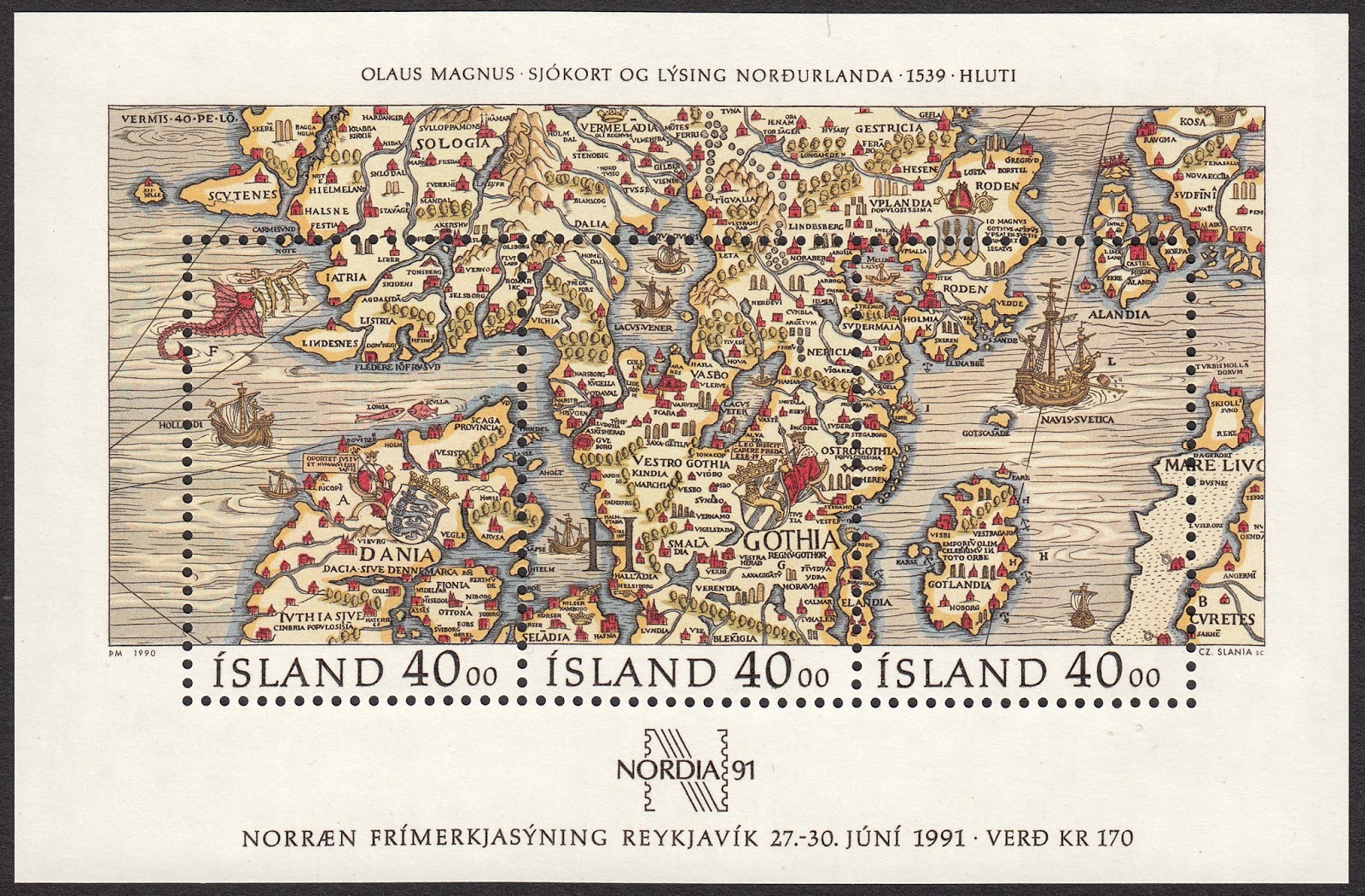
The Carta Marina is the earliest known map of the Nordic countries in existence. This incredible map took twelve years to produce, and drew upon the ancient maps of Ptolemy and the more contemporary works of the Bavarian astronomer, Jacob Ziegler.
Published in Venice in 1539, this beautiful map was the work of the Swedish ecclesiastic, Olaus Magnus, The full name for this map Carta marina et descriptio septentrionalium terrarum The original version of this map measured an impressive 1.70 m wide by 1.25 m high. A colour reproduction was printed in 1572. The strikingly intricate detail of this map incorporates the Nordic lands of Svecia (Svealand), Gothia (Götaland), Norvegia (Norway), Dania (Denmark), Islandia (Iceland), Finlandia (Finland), and Livonia (Estonia and Latvia).
***
On 9 October 1990 Iceland issued a stunning Souvenir Sheet to raise money for the 1991 Nordia Stamp Exhibition. This Souvenir Sheet was engraved by Czeslaw Slania. It comprises 3 stamps, each with a value of 40kr. But each sheet actually sold for 170kr. This Souvenir Sheet illustrates a fragment of the Carta Marina focusing on the southern Nordic countries of Denmark, Sweden, Aland Islands, and Gotland. To read my blog on the fragment of the map depicting the sea between Iceland and Norway, click HERE
***
Let's take a closer look at each stamp within the sheet to better appreciate the exquisite details created by Slania.
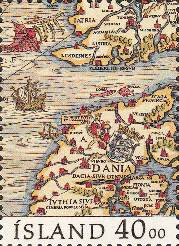
One part of this stamp which stands out for me is at the top left. Some guy has decided to go swimming naked in the ocean, he is now being eaten alive by the fish!
***
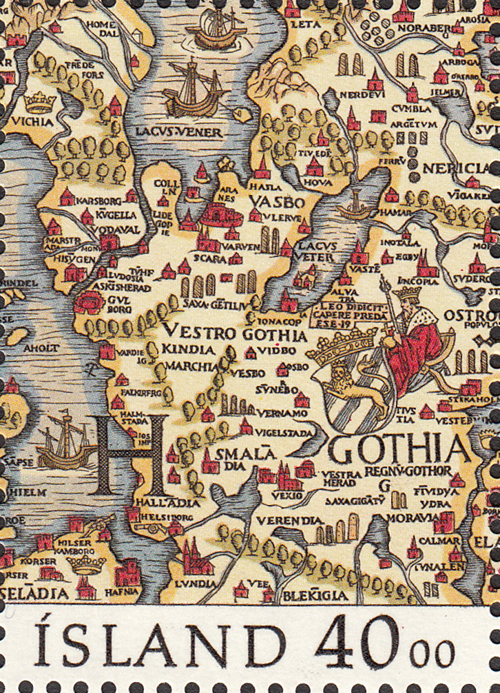
Just look at the sheer number of place names Slania has been able to incorporate in this one stamp! Incredible!
***
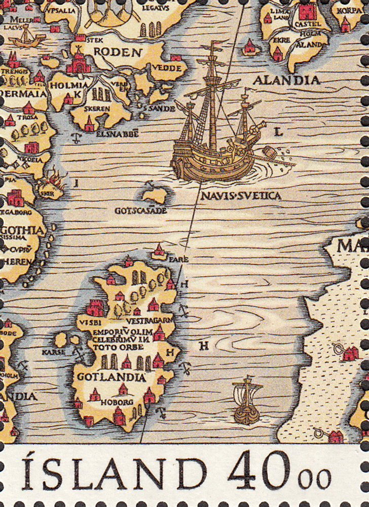
If you look closely, Slania has even included tiny little houses and castles to represent populated areas. And it looks like the ship at top centre has lost a barrel.
Until next time...
No comments:
Post a Comment