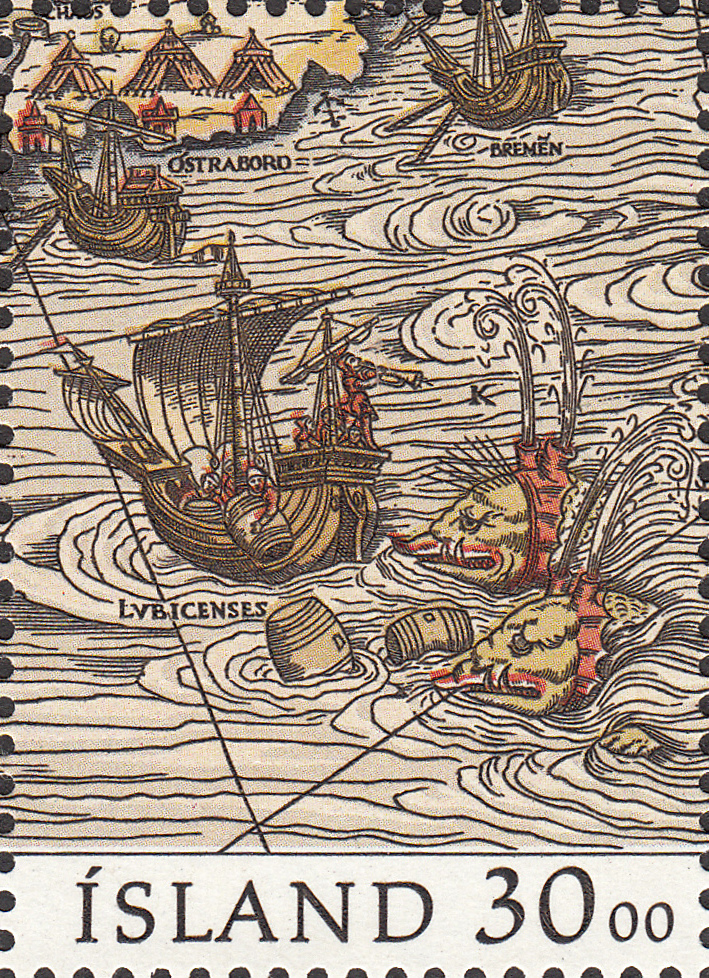
It took twelve years to produce, and drew upon the ancient maps of Ptolemy and the more contemporary works of the Bavarian astronomer, Jacob Ziegler. The Carta Marina is the earliest known map of the Nordic countries in existence.

Published in Venice in 1539, this beautiful map was the work of the Swedish ecclesiastic, Olaus Magnus, The full name for this map Carta marina et descriptio septentrionalium terrarum Now, that is a big name! Speaking of big, the original version of this map measured an impressive 1.70 m wide by 1.25 m high. A colour reproduction was printed in 1572. The strikingly intricate detail of this map incorporates the Nordic lands of "Svecia" (Svealand), "Gothia" (Götaland), "Norvegia" (Norway), Dania (Denmark), Islandia (Iceland), Finlandia (Finland), and Livonia (Estonia and Latvia). Interestingly, a 10-year copyright was placed on the original version of this map by Pope Paul III. At the end of this 10 years the map naturally fell into obscurity to the point that centuries later, some speculated whether it even existed! Then in 1896 a copy of the map surfaced, putting that little controversy to bed for good.
***
On 9 October 1989 Iceland issued a stunning Souvenir Sheet to raise money for the 1991 Nordia Stamp Exhibition. This Souvenir Sheet was engraved by Czeslaw Slania. It comprises 3 stamps, each with a value of 30kr. But each sheet actually sold for 130kr.
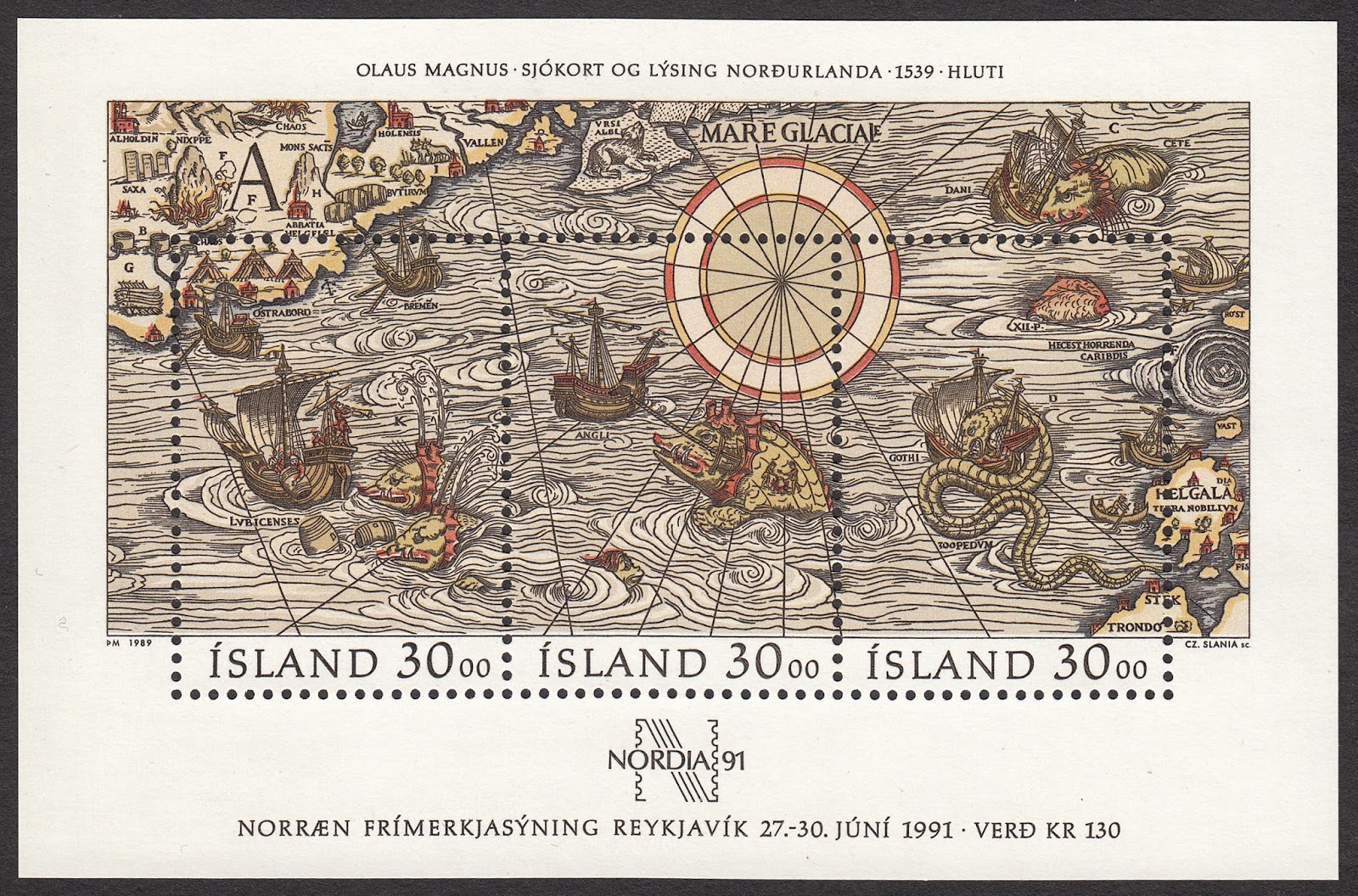
This is yet another exquisite example of Slana's ability to reproduce ancient maps on stamps, including the minutest details. That said, a closer look at each stamp on the sheet and some other detail is warranted...


Until next time...
No comments:
Post a Comment